nwSnowboarding.com 2.1
Forecasts
Issued by: National Weather Service Seattle, WA
Last Update: 236 AM PDT Tue Jul 28 2026
Tonight: Mostly cloudy. A slight chance of rain in the evening. Snow level near 8000 feet. Lows in the upper 40s. West wind in the passes around 10 mph in the evening becoming light. Gusts to 25 mph.
Wednesday: Mostly sunny. Freezing level near 13000 feet. Afternoon pass temperatures in the upper 60s. Light wind.
Wednesday Night: Mostly clear. Freezing level near 14000 feet. Lows in the mid 40s. Light wind.
Thursday: Sunny. Freezing level near 14000 feet. Afternoon pass temperatures in the lower 70s. Light wind.
Thursday Night: Mostly clear. Freezing level near 14000 feet. Lows in the upper 40s.
Friday: Sunny. Freezing level near 14500 feet. Afternoon pass temperatures in the upper 70s.
Friday Night: Mostly clear. Freezing level near 15000 feet. Lows in the lower 50s.
Saturday: Sunny with a slight chance of rain in the morning, then mostly cloudy with a chance of rain and snow in the afternoon. Snow level near 9500 feet. Afternoon pass temperatures in the mid 60s.
Saturday Night: Mostly cloudy with a chance of rain and snow. Snow level near 8000 feet. Lows in the mid 40s.
Sunday: Partly sunny. A chance of rain and snow. Snow level near 7000 feet. Afternoon pass temperatures in the upper 50s.
Sunday Night: Partly cloudy. Freezing level near 10500 feet. Lows in the lower 40s.
Monday: Sunny. Freezing level near 11000 feet. Afternoon pass temperatures in the lower 70s.
Issued by: National Weather Service Pendleton, OR
Last Update: 11:46 pm PDT Jul 27, 2026
Tuesday: Partly sunny, with a high near 65. Calm wind becoming west 5 to 8 mph in the morning. Winds could gust as high as 20 mph.
Tuesday Night: Mostly cloudy, with a low around 49. West wind around 6 mph becoming calm in the evening. Winds could gust as high as 18 mph.
Wednesday: Sunny, with a high near 70. Calm wind becoming west around 6 mph in the afternoon.
Wednesday Night: Mostly clear, with a low around 47. West wind around 6 mph becoming calm in the evening.
Thursday: Sunny, with a high near 71.
Thursday Night: Mostly clear, with a low around 49.
Friday: Sunny, with a high near 77.
Friday Night: Mostly clear, with a low around 52.
Saturday: A slight chance of showers after 11am. Mostly sunny, with a high near 67.
Saturday Night: A chance of showers. Mostly cloudy, with a low around 48.
Sunday: A chance of showers. Partly sunny, with a high near 62.
Sunday Night: Mostly clear, with a low around 45.
Monday: Sunny, with a high near 72.
47.41°N 121.41°W (Elev. 2812 ft)
Issued by: National Weather Service Seattle, WA
Last Update: 11:26 pm PDT Jul 27, 2026
Tuesday: Partly sunny, with a high near 62. West southwest wind 5 to 8 mph, with gusts as high as 20 mph.
Tuesday Night: Mostly cloudy, with a low around 47. West wind 5 to 8 mph, with gusts as high as 20 mph.
Wednesday: Mostly cloudy, then gradually becoming sunny, with a high near 69. West wind 3 to 6 mph.
Wednesday Night: Mostly clear, with a low around 46. West wind 3 to 7 mph.
Thursday: Sunny, with a high near 71.
Thursday Night: Mostly clear, with a low around 48.
Friday: Sunny, with a high near 77.
Friday Night: Mostly clear, with a low around 51.
Saturday: Mostly sunny, with a high near 65.
Saturday Night: A chance of rain. Mostly cloudy, with a low around 45.
Sunday: A chance of rain. Mostly sunny, with a high near 59.
Sunday Night: Partly cloudy, with a low around 42.
Monday: Sunny, with a high near 71.
47.75°N 121.09°W (Elev. 4879 ft)
Issued by: National Weather Service Seattle, WA
Last Update: 11:26 pm PDT Jul 27, 2026
Tuesday: A chance of rain and thunderstorms before 3pm, then showers likely and possibly a thunderstorm between 3pm and 5pm, then rain likely and possibly a thunderstorm after 5pm. Mostly cloudy, with a steady temperature around 52. South wind 8 to 14 mph, with gusts as high as 25 mph. Chance of precipitation is 70%. New rainfall amounts of less than a tenth of an inch, except higher amounts possible in thunderstorms.
Tuesday Night: A 30 percent chance of rain before 8pm. Mostly cloudy, with a steady temperature around 51. South southwest wind around 5 mph becoming calm in the evening.
Wednesday: Mostly sunny, with a high near 62. Calm wind becoming west 5 to 7 mph in the afternoon.
Wednesday Night: Partly cloudy, with a low around 45. West wind 5 to 8 mph becoming calm in the evening.
Thursday: Sunny, with a high near 64.
Thursday Night: Mostly clear, with a low around 47.
Friday: Sunny, with a high near 68.
Friday Night: Mostly clear, with a low around 51.
Saturday: Rain likely, mainly after 11am. Partly sunny, with a high near 58.
Saturday Night: A chance of rain. Mostly cloudy, with a low around 44.
Sunday: A chance of rain. Partly sunny, with a high near 54.
Sunday Night: Partly cloudy, with a low around 42.
Monday: Mostly sunny, with a high near 63.
48.86°N 121.68°W (Elev. 4265 ft)
Issued by: National Weather Service Seattle, WA
Last Update: 11:26 pm PDT Jul 27, 2026
Tuesday: Mostly sunny, with a high near 58. West wind 8 to 13 mph, with gusts as high as 24 mph.
Tuesday Night: Mostly cloudy, with a low around 43. Northwest wind 6 to 13 mph, with gusts as high as 23 mph.
Wednesday: Mostly sunny, with a high near 64. Northwest wind 5 to 10 mph, with gusts as high as 20 mph.
Wednesday Night: Mostly clear, with a low around 42. West wind 5 to 11 mph, with gusts as high as 21 mph.
Thursday: Sunny, with a high near 65.
Thursday Night: Mostly clear, with a low around 44.
Friday: Sunny, with a high near 70.
Friday Night: Mostly clear, with a low around 47.
Saturday: Sunny, with a high near 61.
Saturday Night: Partly cloudy, with a low around 41.
Sunday: Sunny, with a high near 55.
Sunday Night: Mostly clear, with a low around 40.
Monday: Sunny, with a high near 64.
46.93°N 121.49°W (Elev. 5233 ft)
WSDOT
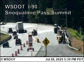
Snoqualmie Pass I-90
Road Condition: Reports have ended for this season. Traditionally weather and road conditions are reported on this page from November 1 to April 1. Should adverse weather occur that will impact travel, updates will be provided as information is available.Temp: 52°F
Weather: Travel impacts will be updated here if conditions cause delays of an hour or more. For other cross-state travel conditions, check WSDOT's real-time travel map.
Restrictions: No restrictions
⚠️ Travel Advisory Active
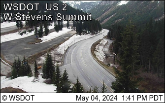
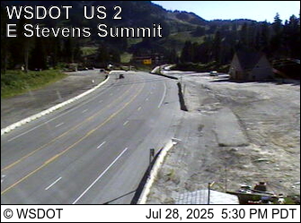
Stevens Pass US 2
Road Condition: Reports have ended for this season. Traditionally weather and road conditions are reported on this page from November 1 to April 1. Should adverse weather occur that will impact travel, updates will be provided as information is available.Weather:
Restrictions: No restrictions
⚠️ Travel Advisory Active
Webcams